
Current NWS Watches and Warnings

Current U.S. Drought Monitor

Today's Weather Forecast


Current Surface Analysis

SPC Storm Reports
Today's Reports

Yesterday's Reports

Yesterday's Reports
Current U.S. Jetstream

Current Wind Shear
ENSO El Niño / La Niña Probabilities


NOAA Solar Power Weather Radio
Severe Weather Categories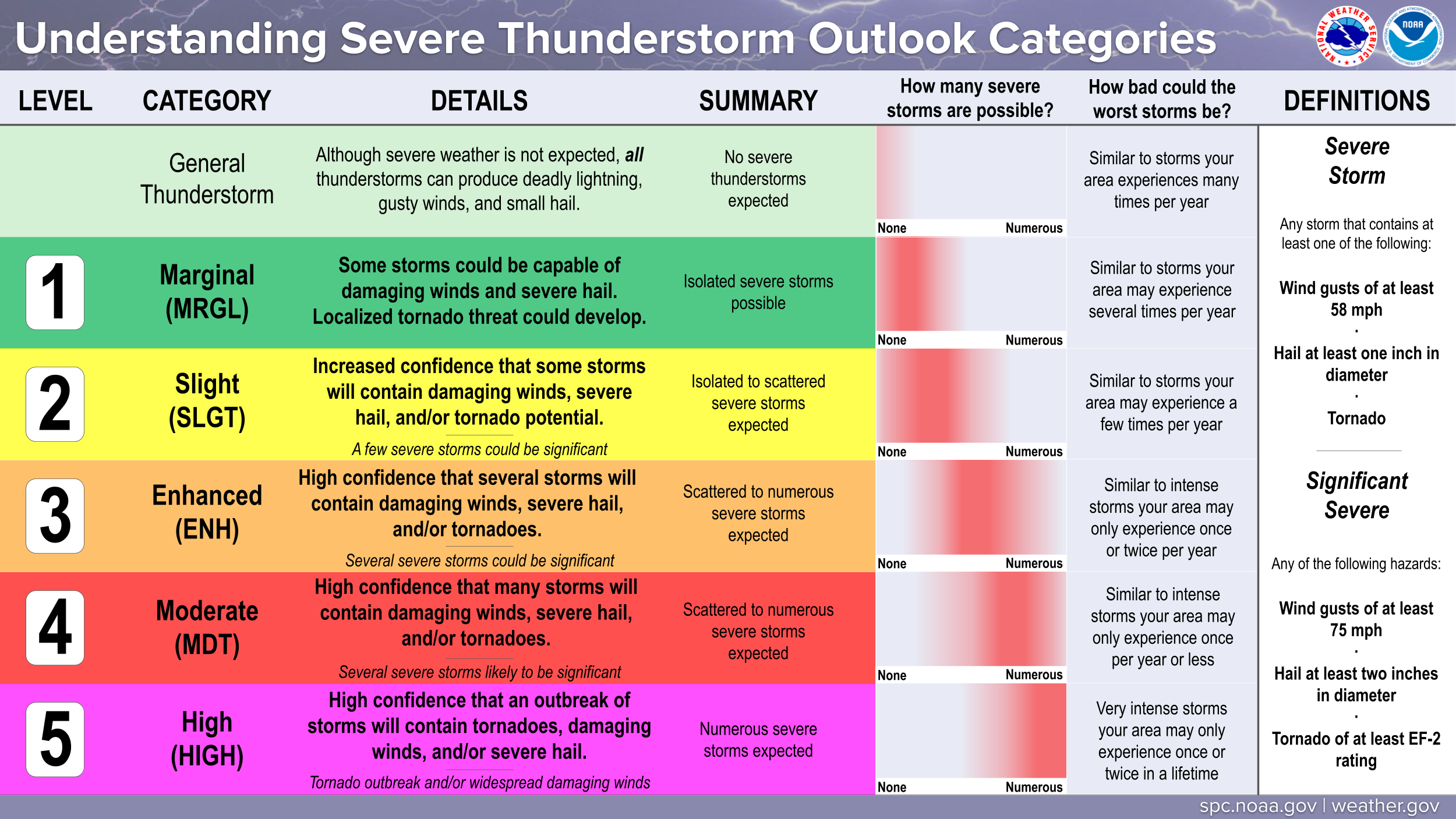
SPC Day 1 Outlook
 SPC Day 2 Outlook
 SPC Day 3 Outlook

SPC Day 2 Outlook
SPC Day 3 Outlook
Current CONUS Radar Loop


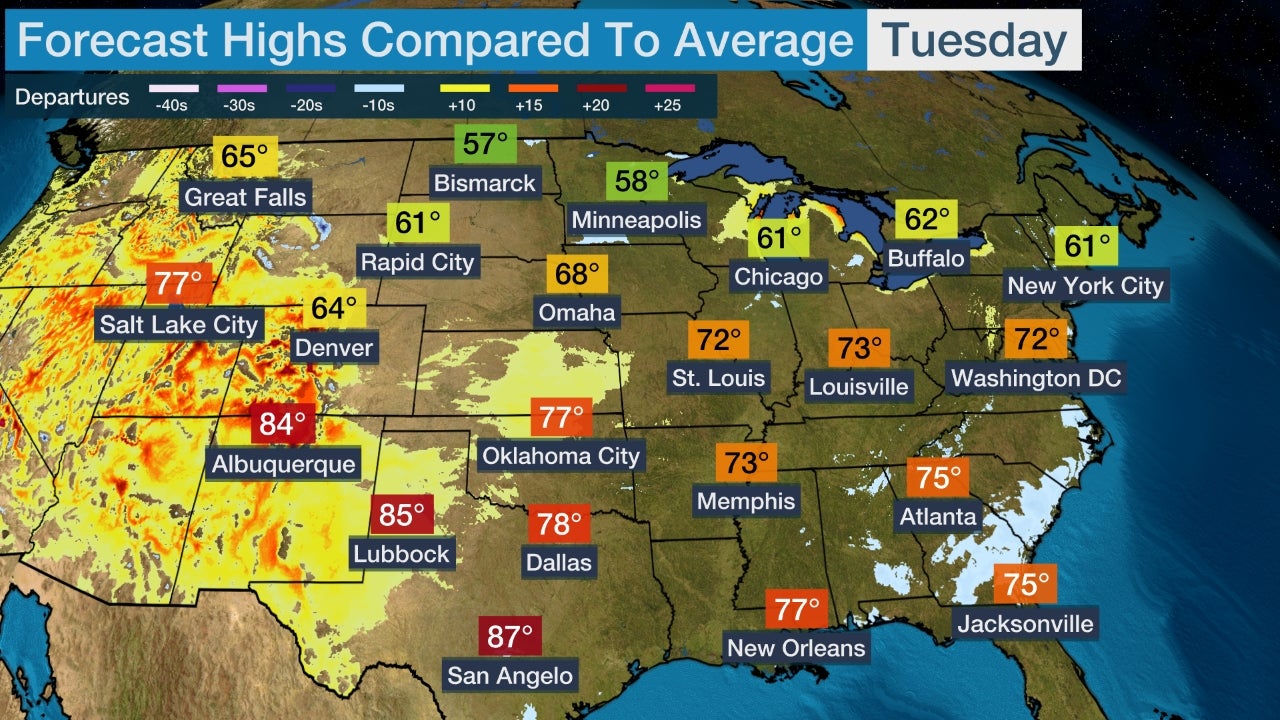
Daytime High Temp Forecast
 Nighttime Low Temp Forecast

Nighttime Low Temp Forecast
CONUS Satellite Loops
GEOColor IR

Shortwave IR

Visible

Water Vapor

Shortwave IR
Visible
Water Vapor
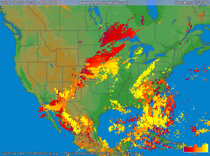
CONUS Lightning Strikes
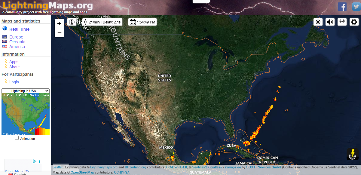
REAL TIME LightningMaps.Org
Past 2 Hours

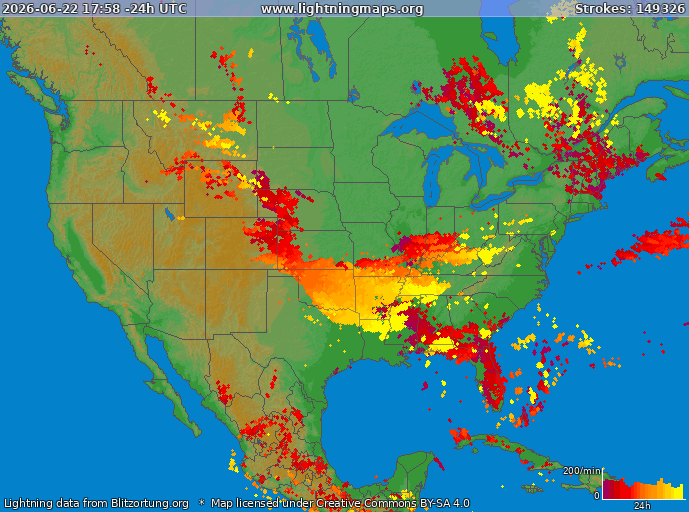
Past 24 Hours
Past 48 Hours
Past 2 Hours
Past 24 Hours
Past 48 Hours
Current Satellite Radar
SPC Current Activity Map
SPC Fire Weather Outlook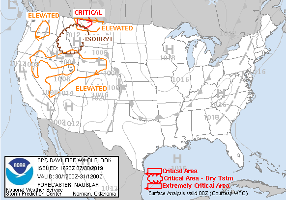
Days 3-7 U.S. Hazards Outlook
SOUTHERN REGION Outlooks
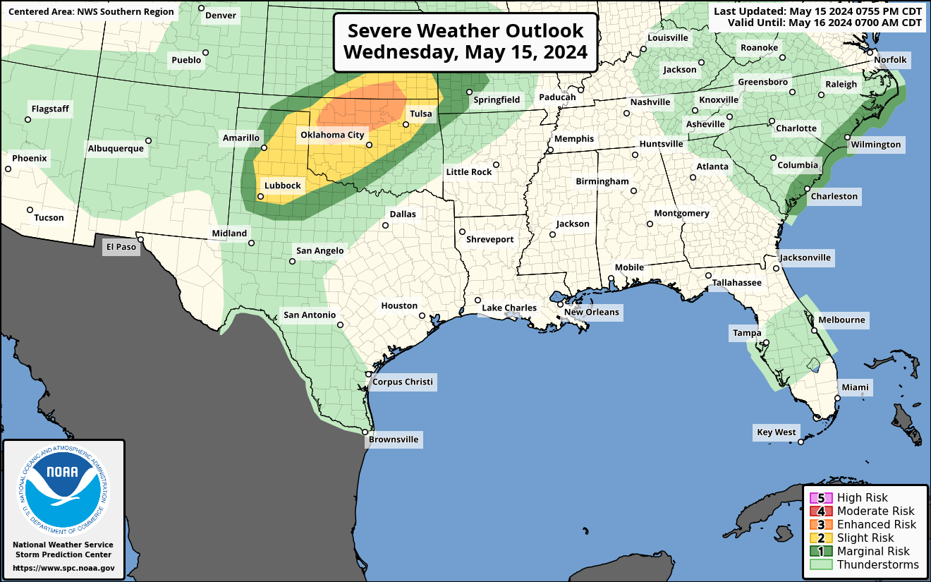
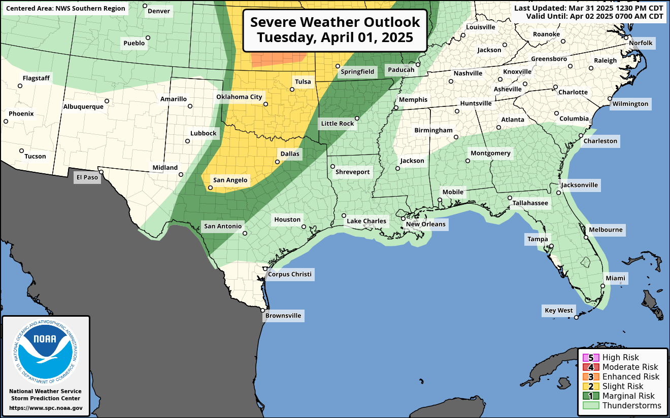
SPC Day 1 Severe Weather Outlook
 SPC Day 2 Severe Weather Outlook
 SPC Day 3 Severe Weather Outlook
 SPC Day 1 Tornado Outlook
 SPC Day 2 Tornado Outlook
 SPC Day 1 Severe Wind Outlook
 SPC Day 2 Severe Wind Outlook
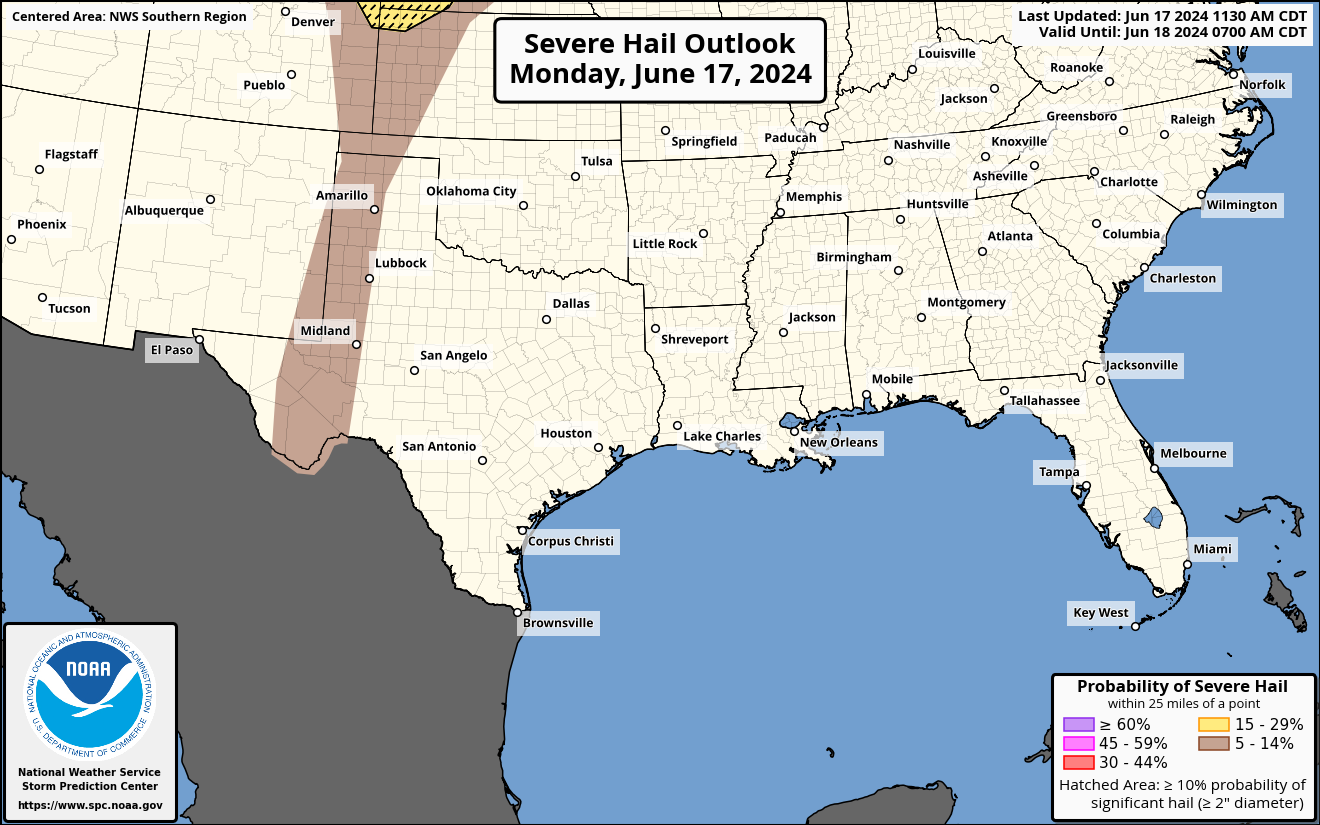
 SPC Day 1 Severe Hail Outlook
 SPC Day 2 Severe Hail Outlook

SPC Day 2 Severe Weather Outlook
SPC Day 3 Severe Weather Outlook
SPC Day 1 Tornado Outlook
SPC Day 2 Tornado Outlook
SPC Day 1 Severe Wind Outlook
SPC Day 2 Severe Wind Outlook
SPC Day 1 Severe Hail Outlook
SPC Day 2 Severe Hail Outlook
WESTERN REGION Outlooks
SPC Day 1 Severe Weather Outlook
 SPC Day 2 Severe Weather Outlook
 SPC Day 3 Severe Weather Outlook
 SPC Day 1 Tornado Outlook
 SPC Day 2 Tornado Outlook
 SPC Day 1 Severe Wind Outlook
 SPC Day 2 Severe Wind Outlook
 SPC Day 1 Severe Hail Outlook
 SPC Day 2 Severe Hail Outlook

SPC Day 2 Severe Weather Outlook
SPC Day 3 Severe Weather Outlook
SPC Day 1 Tornado Outlook
SPC Day 2 Tornado Outlook
SPC Day 1 Severe Wind Outlook
SPC Day 2 Severe Wind Outlook
SPC Day 1 Severe Hail Outlook
SPC Day 2 Severe Hail Outlook
3 Month Seasonal Temperature Outlook

Current Air Quality Index (AQI)
Current SPC Watches
Current Mesoscale Discussions
Days 8-14 U.S. Hazards Outlook
EASTERN REGION Outlooks
SPC Day 1 Severe Weather Outlook
 SPC Day 2 Severe Weather Outlook
 SPC Day 3 Severe Weather Outlook
 SPC Day 1 Tornado Outlook
 SPC Day 2 Tornado Outlook
 SPC Day 1 Severe Wind Outlook
 SPC Day 2 Severe Wind Outlook
 SPC Day 1 Severe Hail Outlook
 SPC Day 2 Severe Hail Outlook

SPC Day 2 Severe Weather Outlook
SPC Day 3 Severe Weather Outlook
SPC Day 1 Tornado Outlook
SPC Day 2 Tornado Outlook
SPC Day 1 Severe Wind Outlook
SPC Day 2 Severe Wind Outlook
SPC Day 1 Severe Hail Outlook
SPC Day 2 Severe Hail Outlook
CENTRAL REGION Outlooks
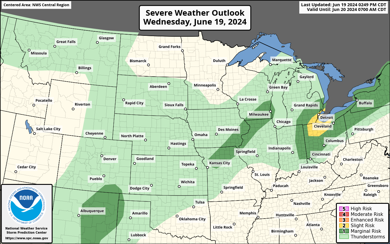
SPC Day 1 Severe Weather Outlook
 SPC Day 2 Severe Weather Outlook
 SPC Day 3 Severe Weather Outlook
 SPC Day 1 Tornado Outlook
 SPC Day 2 Tornado Outlook
 SPC Day 1 Severe Wind Outlook
 SPC Day 2 Severe Wind Outlook
 SPC Day 1 Severe Hail Outlook
 SPC Day 2 Severe Hail Outlook

SPC Day 2 Severe Weather Outlook
SPC Day 3 Severe Weather Outlook
SPC Day 1 Tornado Outlook
SPC Day 2 Tornado Outlook
SPC Day 1 Severe Wind Outlook
SPC Day 2 Severe Wind Outlook
SPC Day 1 Severe Hail Outlook
SPC Day 2 Severe Hail Outlook
3 Month Seasonal Precipitation Outlook
